 The system had been under development by the Defense Department for 18 years.
Signals from three or more Navstar satellites enable receivers on earth to
calculate latitude, longitude and altitude to within about 100 feet.
The system had been under development by the Defense Department for 18 years.
Signals from three or more Navstar satellites enable receivers on earth to
calculate latitude, longitude and altitude to within about 100 feet.
During Operation Desert Storm, soldiers trying to find their bearings in the
desert landscape relied on handheld GPS receivers.
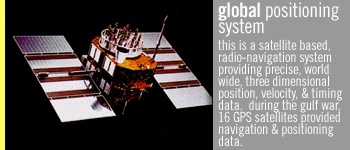
The concept of the GPS system is simple, With the help of an onboard atomic
clock, each satellite in the network continuously broadcasts a signal indicating
the time and the spacecraft's exact position. There is a total of 24 satellites,
including three spares. A GPS receiver uses simultaneous readings from three
different satellites to "fix" the user's longitude and latitude.
Relying on satellites rather than ground stations makes the system more precise
than conventional navigation technology.
After the Gulf War, the U.S. Army announced it would install GPS in all armored
vehicles to help minimize friendly fire incidents which became a major source of
casualties in Operation Desert Storm. Friendly fire incidents most often were
caused by armored unit commanders who were lost in the featureless Iraqi desert
or were out of position during ground attacks.
The GPS devices would enable commanders of M1 Abrams tanks and Bradley Fighting
Vehicles to get their exact location. During the Gulf War, the GPS devices were
in short supply.

"NAVSTAR GPS played a key role and has many applications in all functional
war-fighting areas. Land navigation was the biggest beneficiary, giving
Coalition forces a major advantage over the Iraqis." (Dept. of Defense Report
to Congress, "Conduct of the Persian Gulf War," Vol II, April 1992)
"GPS was a godsend for ground troops traversing the desert, especially in the
frequent sandstorms....Tanks crews and drivers of all sorts of vehicles swore by
the system. Meal trucks were equipped with GPS receivers to enable drivers to
find and feed soldiers of frontline units widely dispersed among the dunes."
(Air Force Magazine, Aug 91, pp. 35)
"The Kuwait war was the first combat use of the system, and it was hugely
successful. It made possible all the big night maneuvers that in the past would
have required numerous scouts and guides along the routes of advance. GPS can be
switched to coded transmissions that can be used only by special receivers. In
the event, not enough special receivers were available, so the GPS network could
not be switched to the coded mode. That meant anyone, including the Iraqis, who
had a standard GPS receiver (which is widely available commercially) could use
GPS to find his own position. Considerable publicity was given to this apparent
lapse in U.S. equipment, but it made little difference, since the GPS itself does
not give away the positions of attackers.
GPS made it possible for the attackers to shift their attack plans back and forth
virtually up to the moment of attack, since forces using it had no need for fixed
markers on the ground. The marines reported that they kept aadjusting their
breaching point as they received fresh intelligence of Iraqi positions, and as
the Iraqis moved their forces." --From: "Desert Victory - The War for Kuwait"
by Norman Friedman Naval Institute Press 1991.
home · oral history · war stories · weapons · maps · chronology
tapes & transcripts
FRONTLINE · wgbh · pbs online
web site copyright WGBH educational foundation
|